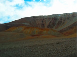
CERRO AMARILLO PROJECT
 |
| See Project Map |
This project is located in the District of Iglesia, Cerro Amarillo, Paraje Macho Muerto, San Juan Province.
The Environmental Impact Report has been submitted by dossier Number 1100-0511-S-2012 for the prospection stage.
It includes 6 properties:
1.1. Discovery Statement Dossier number 156286-S-76 named “MOGOTES 10”.
1.2. Mineral: disseminated copper.
1.3. Location: Mining District 1. It is 54 ha corresponding to 6 mineral rights.
REQUESTED COORDINATES:
| Map Projection Gauss Kruger Datum Campo Inchauspe (CAI) Transformation Parameter DMA/NIMA |
||
| Vertex | (X) Norte | (Y) Este |
| 1 | 6839145.19 | 2436480.50 |
| 2 | 6839145.19 | 2380000.00 |
| 3 | 6839445.19 | 2376000.00 |
| 4 | 6839745.19 | 2376000.00 |
| 5 | 6840945.19 | 2380000.00 |
| 6 | 6840945.19 | 2436480.50 |
2.1. Discovery Statement Dossier number 156272-S-76 named “AMARILLO 17”.
2.2. Mineral: disseminated copper.
2.3. Location: Mining District 1. It is 54 ha corresponding to 6 mineral rights.
REQUESTED COORDINATES:
| Map Projection Gauss Kruger Datum Campo Inchauspe (CAI) Transformation Parameter DMA/NIMA |
||
| Vertex | (X) Norte | (Y) Este |
| 1 | 6832812.46 | 2441297.47 |
| 2 | 6832812.46 | 2441597.47 |
| 3 | 6831012.46 | 2441597.47 |
| 4 | 6831012.46 | 2441297.47 |
3.1. Discovery Statement Dossier number 156294-S-76 named “BORDO ATRAVEZADO”.
3.2. Mineral: disseminated copper
3.3. Location: Mining District 1. It is 54 ha corresponding to 6 mineral rights.
REQUESTED COORDINATES:
| Map Projection Gauss Kruger Datum Campo Inchauspe (CAI) Transformation Parameter DMA/NIMA |
||
| Vertex | (X) Norte | (Y) Este |
| 1 | 6823857.00 | 2443974.00 |
| 2 | 6822057.00 | 2443974.00 |
| 3 | 6822057.00 | 2443974.00 |
| 4 | 6823857.00 | 2443974.00 |
4.1. Discovery Statement Dossier number 156304-S-76 named “LOMA DE EUGENIO 1”.
4.2. Mineral: disseminated copper.
4.3. Location: Mining District 1. It is 54 ha corresponding to 6 mineral rights.
REQUESTED COORDINATES:
| Map Projection Gauss Kruger Datum Campo Inchauspe (CAI) Transformation Parameter DMA/NIMA |
||
| Vertex | (X) Norte | (Y) Este |
| 1 | 6825504.88 | 2439935.44 |
| 2 | 6825504.88 | 2441735.44 |
| 3 | 6825204.88 | 2441735.44 |
| 4 | 6825204.88 | 2439935.44 |
5.1. Discovery Statement Dossier number 156258-S-76 named “AMARILLO 3”.
5.2. Mineral: disseminated copper.
5.3. Location: Mining District 1. It is 54 ha corresponding to 6 mineral rights.
REQUESTED COORDINATES:
| Map Projection Gauss Kruger Datum Campo Inchauspe (CAI) Transformation Parameter DMA/NIMA |
||
| Vertex | (X) Norte | (Y) Este |
| 1 | 6829062.00 | 2441350.00 |
| 2 | 6829062.00 | 2441650.00 |
| 3 | 6827262.00 | 2441650.00 |
| 4 | 6827262.00 | 2441350.00 |
6.1. Discovery Statement Dossier number 1124-657- C-2010 named “AMARILLO II”.
6.2. Mineral: Gold and disseminated copper.
6.3. Location: Mining District 1. It is 11,2631 ha.
REQUESTED COORDINATES:
| Map Projection Gauss Kruger Datum Campo Inchauspe (CAI) Transformation Parameter DMA/NIMA |
||
| Vertex | (X) Norte | (Y) Este |
| 1 | 6828100.00 | 2440811.13 |
| 2 | 6828100.00 | 2441011.13 |
| 3 | 6827225.00 | 2441011.13 |
| 4 | 6827225.00 | 2440811.13 |
